Top Intermediate Level Hiking Trails Near Cafayate
Cafayate is famous for its high-altitude vineyards and stunning red rock formations. Many travelers come for the wine but stay for the landscape. Finding the right intermediate level hiking trails near Cafayate Argentina allows you to see the desert up close. These trails offer a mix of rugged terrain and breathtaking views. Most routes involve sandy paths or rocky climbs. You will experience the unique geomorphology of the North. Always prepare for the intense sun and high elevation in this region.
Quick Picks for Hiking in Cafayate
Before diving into the details, here is a quick guide for your trip planning. These selections help you choose based on your specific interests for 2026.
- Best Overall: Cascadas del Río Colorado
- Best for Photography: Los Castillos Loop
- Best Adventure: El Divisadero
- Best Short Challenge: Garganta del Diablo
Each trail offers a unique look at the Calchaquí Valleys area. Make sure to carry enough water regardless of your choice.
Top Intermediate Level Hiking Trails Near Cafayate Argentina
This list features the most rewarding trails for active travelers. They range from desert scrambles to waterfall climbs. These are the best hiking trails in Cafayate for those seeking a moderate challenge.
-
Name: Cascadas del Río Colorado
Type: Waterfall Hike
Why go: This trail leads through seven beautiful waterfalls in a desert canyon. It involves some scrambling over rocks.
Best for: Nature lovers
Where: 6km southwest of town
Time: 3-4 hours
Cost: Small entry fee to the local community
Getting there: Take a local taxi or bike to the trailhead.
Tip: Hiring a local guide is highly recommended to find the best route. -
Name: El Divisadero
Type: Archaeological Hike
Why go: You will see ancient ruins and cave paintings while climbing higher into the hills. The panoramic views of the valley are incredible.
Best for: History buffs
Where: 7km from the city center
Time: 2-3 hours
Cost: Low-cost entry fee
Getting there: Short drive or bike ride via Route 40.
Tip: Look for the "Pinturas Rupestres" signs to see the art properly. -
Name: Las Moyas Trail
Type: Hillside Trek
Why go: This path takes you through interesting rock shapes that look like petrified sponges. It is less crowded than other spots.
Best for: Solitude
Where: North of the town center
Time: 2 hours
Cost: Free
Getting there: Accessible by foot from the edges of Cafayate.
Tip: Go in the early morning to avoid the strongest midday heat. -
Name: Los Castillos Viewpoint Loop
Type: Scenic Viewpoint
Why go: This area is part of the Quebrada de las Conchas stops known for deep red sandstone. The hike takes you behind the formations for better perspectives.
Best for: Photographers
Where: 18km from town on Route 68
Time: 1.5-2 hours
Cost: Free
Getting there: Rent a car or take a bus toward Salta.
Tip: The "Golden Hour" light here is spectacular for your camera. -
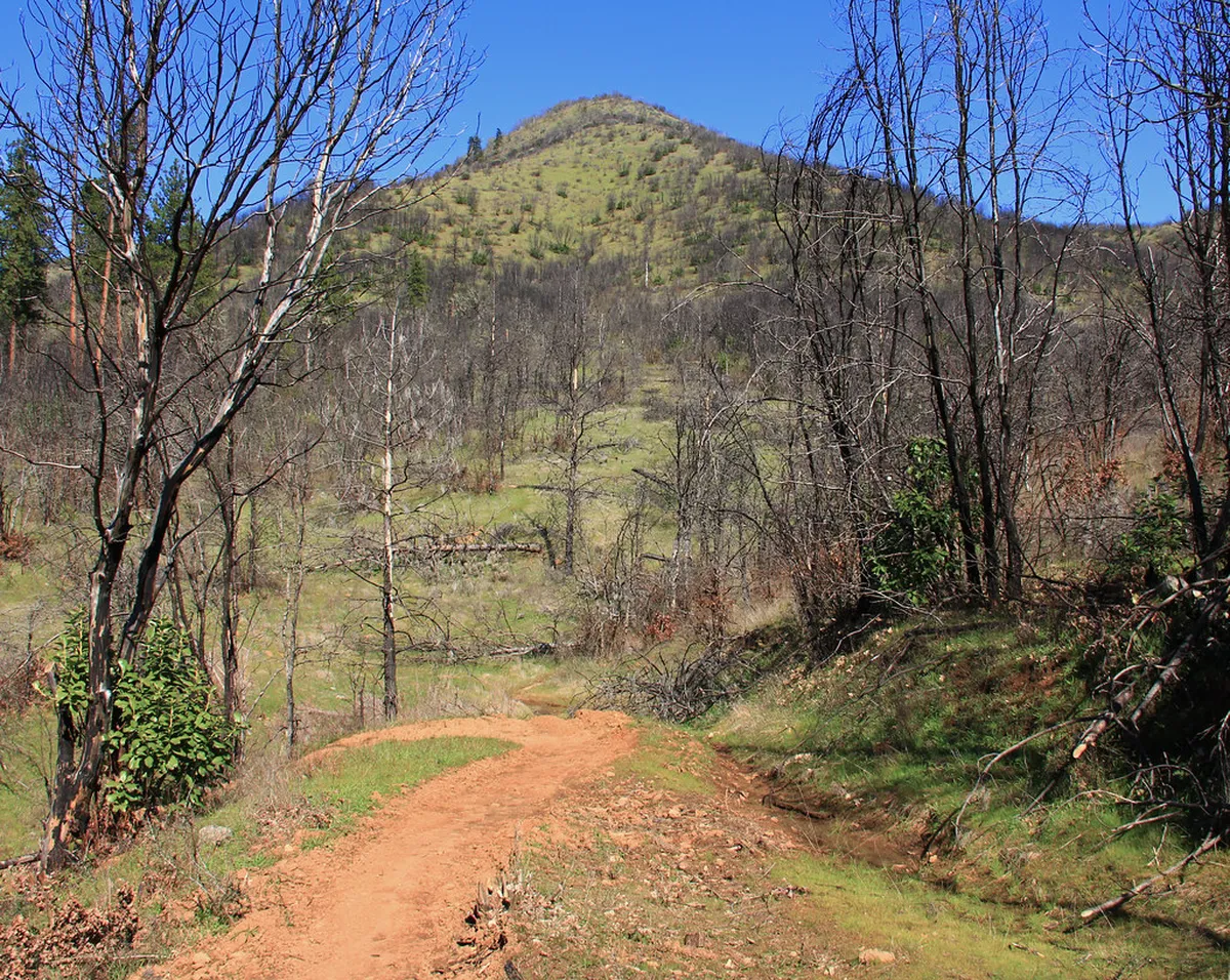
Name: Cerro San Isidro Lower Slopes
Type: Peak Ascent
Why go: Climbing the lower portion of this peak offers the best aerial view of the vineyards. The trail is steep but manageable for intermediate hikers.
Best for: Fitness enthusiasts
Where: West edge of the city
Time: 3 hours
Cost: Free
Getting there: Walk from the main plaza toward the mountains.
Tip: The soil can be loose, so wear shoes with good grip. -
Name: Garganta del Diablo Scramble
Type: Canyon Activity
Why go: While the entrance is easy, hiking up into the "throat" requires balance and strength. It is a thrilling vertical experience.
Best for: Thrill seekers
Where: 45km from Cafayate
Time: 1 hour
Cost: Free
Getting there: Better reached by car via Route 68.
Tip: Do not attempt to climb high during or after rainfall. -
Name: El Anfiteatro Surrounds
Type: Canyon Exploration
Why go: Beyond the famous acoustic chamber, there are higher paths through the red cliffs. You can explore the narrow ridges safely.
Best for: Explorers
Where: Quebrada de las Conchas
Time: 1.5 hours
Cost: Free
Getting there: Stop at the Anfiteatro parking on Route 68.
Tip: Bring a wide-angle lens for the towering canyon walls. -
Name: Los Médanos (Extended Walk)
Type: Sand Dune Trail
Why go: Walking across the white sand dunes at sunset feels magical. It is a slow, steady workout for your legs.
Best for: Couples
Where: 6km northeast of town
Time: 2 hours
Cost: Free
Getting there: Short taxi ride or easy bike ride.
Tip: Wear sandals or go barefoot once you reach the soft sand. -
Name: Quebrada de las Flechas (Day Trip segment)
Type: Geological Hike
Why go: These sharp, angled rock formations look like giant arrows sticking out of the ground. The trails here are rugged and unique.
Best for: Unique landscapes
Where: 60km on Route 40
Time: 3-4 hours (including drive)
Cost: Free
Getting there: You will need a car or a guided tour.
Tip: Check current road conditions at the official site before driving.
Planning Your Hike in the Salta Province
The climate in northern Argentina is arid and harsh. You should know what to pack for hiking in the desert before you arrive. Always bring at least two liters of water per person. The winds can be strong, so a windbreaker is helpful. High-altitude sun burns skin very quickly. Wear a hat and use plenty of sunscreen every day. Local guides offer deep knowledge about the flora and fauna. They also help keep you safe on unmarked trails.
Frequently Asked Questions
What is the best time of year to hike in Cafayate?
The best time is from April to October. These months offer cooler temperatures and dry weather. Summer can be too hot and sometimes brings rain that blocks roads. Spring and autumn provide the most comfortable conditions for intermediate trails.
Do I need a guide for hiking near Cafayate?
For trails like the Rio Colorado waterfalls, a guide is highly recommended. Some paths are not clearly marked and pass through private community land. For shorter walks like Los Médanos, you can easily go on your own. Always tell someone your plans.
Is hiking at this altitude difficult?
Cafayate sits at about 1,683 meters above sea level. This is not extremely high, but you might feel more tired than usual. It is wise to spend one day acclimating before trying the harder intermediate trails. Stay hydrated to avoid headaches.
Cafayate offers some of the most striking intermediate level hiking trails near Cafayate Argentina. From red canyons to high dunes, the variety is impressive. These trails provide a perfect break from the local winery tours. Remember to respect the environment and the local communities. For more ideas on things to do, check out the top attractions near Cafayate for your next visit. Enjoy the stunning beauty of the Salta province!
Official resources
Use these sources for official schedules, tickets, routes, and updates.
- Turismo Salta — Official provincial tourism board; unverified.
- Visit Argentina — Official national tourism board; unverified.
- UNESCO World Heritage Centre — Official UNESCO listing for regional heritage; unverified.
- Lonely Planet — Major international travel guide; unverified.
- Museo de la Vid y el Vino — Official museum of the city; unverified.