The Ultimate Los Cardones Park Guide for 2026
Los Cardones National Park is a jewel in Northwest Argentina. This desert landscape features thousands of giant cacti against colorful mountains. Our Los Cardones park guide will help you navigate this high-altitude wonder. Most travelers visit from the nearby city of Salta. You can explore many top attractions near Salta along the way. These valleys are famous for their unique geology and clear blue skies.
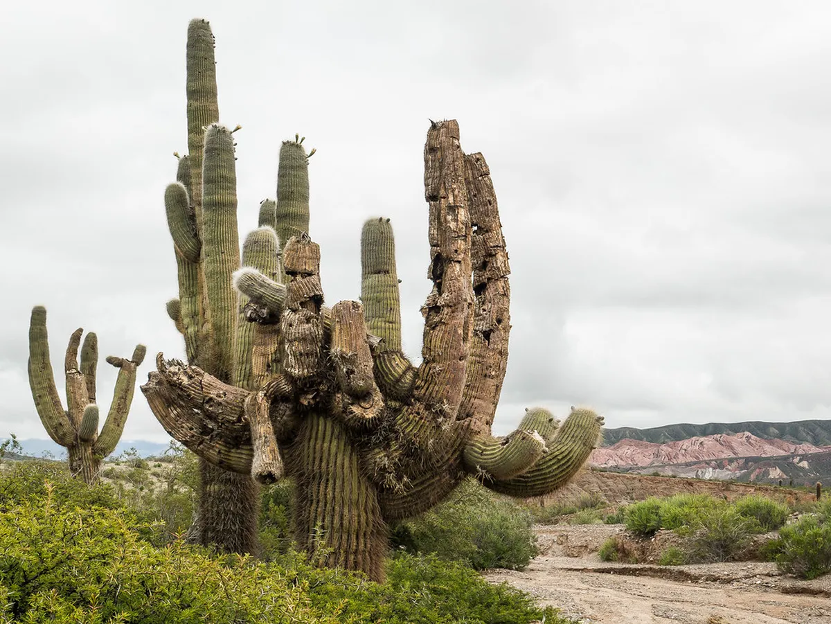
The park covers over 60,000 hectares of arid territory. It protects the giant cardon cacti, which can live for centuries. You will find ancient Inca roads and local wildlife like the guanaco. This guide provides practical tips for a safe trip. Whether you drive yourself or take a tour, the scenery will leave you breathless. Get ready to discover one of the most iconic sights in the Andes.
Preparing for Your Visit to Los Cardones
Visiting this park requires some basic planning. The elevation reaches over 3,000 meters at the highest point. You should drink plenty of water to avoid altitude sickness. Many visitors find it helpful to chew coca leaves or drink tea. These local remedies help you stay comfortable during the climb. The weather is dry and sunny most of the year. However, nights can be very cold even in the summer.
The best time to visit is between April and November. During these months, the sky is usually clear and rain is rare. Always check the official Parques Nacionales Argentina website for current status. You will need a rental car or a guided tour to reach the park. Public transport to the park interior is very limited. Make sure your vehicle has a full tank of gas before leaving Salta.
Pack layers of clothing for the changing temperatures. You will need high SPF sunscreen and a wide-brimmed hat. The mountain sun is very strong at high altitudes. Sturdy walking shoes are important if you plan to hike the trails. Bring your own snacks and drinks as services are scarce inside the park. There are no gas stations or large grocery stores within the park boundaries.
- Best overall: Recta de Tin Tin for iconic photography.
- Best for families: Sendero Ojo del Cóndor for easy walking.
- Best free activity: Viewing the giant cactus forests from the roadside.
- Best for adventure: Hiking the Valle Encantado trails.
10 Must-See Highlights in Los Cardones Park
This section outlines the top sites you should not miss. Each location offers a different view of the park's diverse ecosystem. Use this list to prioritize your stops during your day trip. Most of these sites are easily accessible from Provincial Route 33. This road connects Salta with the Calchaquí Valleys. Keep your camera ready for the incredible panoramas around every corner.
-
Name: Cuesta del Obispo
Type: sight
Why go: It is a stunning winding road that climbs through the mountains.
Best for: Panoramic views and mountain photography.
Where: Road between Salta and Cachi.
Time: 1 hour drive to climb.
Cost: Free.
Tip: Look for the "El Mirador" sign to find the best photo spot. -
Name: Piedra del Molino
Type: viewpoint
Why go: This is the highest point of the journey at 3,348 meters.
Best for: Seeing the clouds below you on clear days.
Where: The summit of Cuesta del Obispo.
Time: 20 minutes.
Cost: Free.
Tip: Visit the tiny stone chapel located right at the pass. -
Name: Recta de Tin Tin
Type: experience
Why go: This is an incredibly straight road built by the Incas.
Best for: Seeing the vast scale of the cactus desert.
Where: Inside the park boundaries.
Time: 15 minutes to drive through.
Cost: Free.
Tip: Pull over carefully to take photos of the road vanishing into the horizon. -
Name: Valle Encantado
Type: viewpoint
Why go: It features unique rock formations and lush vegetation in a hidden valley.
Best for: Short hikes and seeing diverse floral life.
Where: Near the Piedra del Molino summit.
Time: 1-2 hours.
Cost: Small entry fee often applies.
Tip: Check conditions before entering as the path can be muddy after rain. -
Name: Sendero Ojo del Cóndor
Type: activity
Why go: A short, easy walking trail through a dense cactus forest.
Best for: Close-up views of the giant cardon cacti.
Where: Near the Recta de Tin Tin.
Time: 45 minutes.
Cost: Free.
Tip: Stay on the marked trail to protect the fragile desert soil. -
Name: Los Colorados
Type: sight
Why go: Intense red mountains provide a sharp contrast to the green cacti.
Best for: Seeing the colorful geology of the region.
Where: Western edge of the park.
Time: 30 minutes.
Cost: Free.
Tip: The colors are most vibrant during the late afternoon sun. -
Name: Cachipampa
Type: sight
Why go: A wide, arid plain where you can see herds of wild guanacos.
Best for: Wildlife spotting and wide-angle landscapes.
Where: Near the park entrance from Salta.
Time: 20 minutes.
Cost: Free.
Tip: Bring binoculars to see the animals from a safe distance. -
Name: Camino de los Artesanos
Type: experience
Why go: Meet local weavers and buy authentic ponchos near the park.
Best for: Cultural interaction and souvenir shopping.
Where: Close to the Seclantás junction.
Time: 1 hour.
Cost: Varies by purchase.
Tip: Look for the signs indicating "Tejedores" (weavers) along the road. -
Name: Secret Fossil Trails
Type: sight
Why go: This area contains traces of ancient life and dinosaur footprints.
Best for: History buffs and science lovers.
Where: Specific zones managed by park rangers.
Time: 2 hours with a guide.
Cost: Usually via guided tour.
Tip: You must hire a local guide to find the specific fossil locations. -
Name: Nevado del Cachi Viewpoint
Type: sight
Why go: Views of the permanent snow on the highest peaks of the region.
Best for: Viewing the contrast between desert and snow.
Where: Visible from most points along Recta de Tin Tin.
Time: 10 minutes.
Cost: Free.
Tip: The peak reaches 6,380 meters and is visible on any clear day.
Driving the Scenic Route from Salta
Driving from the city of Salta is the best way to see the park. You will start at an altitude of about 1,200 meters. The road follows the Escoipe Gorge, which is green and lush. As you climb, the landscape changes to high-altitude desert. This salta scenic drive route is world famous for its beauty. The road is paved most of the way but has many sharp turns.
Take your time on the mountain passes. Do not rush the Cuesta del Obispo climb. The curves are tight and require careful driving. Most rental cars can handle the trip, but a higher clearance helps. You should start your day early, ideally by 8:00 AM. This gives you plenty of time to stop at all the viewpoints. You will find more information on Salta history to appreciate the local landmarks.
Look for small stalls selling "tortillas a la parrilla" along the road. These grilled flatbreads are often filled with cheese and ham. They are a perfect local snack for your journey. There are also small museums and visitor centers in the nearby towns. Use your Los Cardones park guide to find the best spots to rest. Remember that cell phone service is very spotty in the mountains. Download offline maps before you leave the city.
Top Activities and Day Trips Near the Park
Many people combine their park visit with a trip to Cachi. This colonial village is famous for its white buildings and calm vibe. A Cachi village travel guide can help you find local eateries. It is located just 30 minutes past the park boundaries. You can stay overnight in Cachi to see the park at sunrise. The morning light on the cacti is perfect for photography.
If you prefer a different climate, visit the nearby yungas. The cloud forest hiking guide offers a contrast to the desert. These forests are green, humid, and full of birdlife. They are located on the other side of the mountains near Salta. You can experience two completely different ecosystems in just two days. San Lorenzo is a popular spot for these humid forest walks.
Other travelers choose to visit the salt flats after the park. You can find detailed info on the Salinas Grandes salt flats tour for your next day. These diverse landscapes make Salta a top destination in Argentina. Always check the weather for both regions, as they differ greatly. The desert is dry, while the cloud forest can be very rainy. Both provide unique memories for your South American adventure.
Frequently Asked Questions
Is there an entry fee for Los Cardones National Park?
As of early 2026, there is no general entry fee for driving through the park on Route 33. Some specific trails like Valle Encantado may charge a small maintenance fee. Always carry some local pesos just in case of changes to park regulations.
How long does it take to drive from Salta to Los Cardones?
The drive from Salta city center takes about 2.5 to 3 hours to reach the main cactus forests. This includes time for the steep climb up Cuesta del Obispo. Plan for a full 8-10 hour day if you want to see everything and visit Cachi.
Are there gas stations inside Los Cardones National Park?
No, there are no gas stations or services within the park. You must fill your tank in Salta or wait until you get to Cachi. It is highly recommended to start with a full tank to ensure you can return safely.
Los Cardones National Park offers a unique look at the high-altitude deserts of Argentina. From the winding road of Cuesta del Obispo to the straight Recta de Tin Tin, every mile is scenic. Use this Los Cardones park guide to plan your stops and stay safe at high altitudes. Don't forget to visit the nearby village of Cachi for a taste of colonial history. For more trip ideas, explore our list of top attractions near Salta. Enjoy the giant cacti and the magic of the Calchaquí Valleys!
Official resources
Use these sources for official schedules, tickets, routes, and updates.
- Salta Turismo — unverified
- Municipalidad de Salta — unverified
- Argentina Travel — unverified
- UNESCO World Heritage Centre — unverified
- Lonely Planet Salta — unverified
- MAAM Museum — unverified
- Parques Nacionales Argentina — unverified